
Distance: 6.25 miles
Type: Out and back
Difficulty: Moderate
Kid-friendly: Yes
Dog-friendly: Yes
Water: Yes
The Game Creek Trail is a beautiful 6.25 mile (one way) trail with a moderate elevation change in the lower Gros Ventre Mountains. The trail is popular with hikers, mountain bikers, and equestrian riders. Most who hike it won’t hike the trail in its entirety, but rather, will either hike in a section of it, and/or connect it with another trail for a potential loop or shuttle trip. While the trail features several options to do so, most wind up being lengthy day-hikes.
View more images available as prints from the Gros Ventre Mountains
Game Creek Trail Description
From the Game Creek Trailhead, follow the easy trail as it parallels Game Creek upstream. Up the wide and shallow canyon, you’ll hike along willows and aspens through a primarily large meadow. Just to the right, an evergreen forest ascends up the hillside. Ahead in the distance larger peaks loom as the Gros Ventre Mountains discretely rise beyond the surrounding terrain.
As the vegetation begins to thicken around the trail, you’ll come to an old cattle guard that you can either cross or go around. The trail continues its gentle ascent up the canyon as views of distant mountains begin to appear through widening meadows. All the while, Game Creek is consistently alongside the trail.

The vegetation will begin to narrow again before you emerge into a large meadow along the creek, visibly deeper into the mountains. Soon after, you’ll reach a fork in the trail at 1.5 miles in. The old road heads left, while the official Game Creek Trail heads right. Either way is fine, since they both connect back up in roughly 0.5 miles. Since the official trail goes right, this post will reflect that.
Heading up the single-track and away from the old two-track, you’ll make easy switchbacks up a hill paralleling the road. The easy trail is quite scenic as you wind through sparse aspen trees and lush wildflowers. You’ll quickly descend back down to the road to reconnect with the original trail.
Continuing up the old road, you’ll reach another junction in a large meadow at 2.2 miles in, with a large wide mountain looming ahead. Left will bring you along the Beaver Ponds Trail, while right will continue the Game Creek Trail. Once again, they’ll reconnect; this time 1 mile ahead. Heading right, you’ll wind around willows along the meadow’s edge. The trail snakes down from the hillside to a wide and open canyon bottom, which soon narrows. You’ll continue to wind between the hillside and willows, where you’ll then reconnect with the Beaver Ponds Trail.

Beyond the second detour, you’ll cross a footbridge as you pass a side canyon. The trail winds past more beaver ponds as it then skirts through evergreens. Just past this area, you’ll reach another junction in a narrowing canyon, this one with the West Game Creek Trail at 3.5 miles in. To continue on the Game Creek Trail, head right.
The trail continues up along Game Creek still and through the edge of an evergreen forest. Through here, you’ll notice the trail beginning to get slightly steeper. You’ll soon veer away from the creek as you then twist around through meadows between hills. Continuing to ascend between the hills, you’ll follow the trail as it twists up a drainage along the edge of evergreens. You’ll then cut out of the drainage and wind over to another.
Above you and to the left are large rocky hoodoos and spires high up near the hilltop. Aspen trees soon obstruct the view as you then begin to wrap around the hill. You’ll reach a meadow overlooking the small mountains around you and Game Creek in the distance. The trail then cuts back north through an open hillside, where it passes by and through a series of aspen groves.

Ahead and to the right is a steep mountain, rocky outcroppings popping out from the forests. You’ll continue up the exposed hillside in and out of the aspens, where you’ll soon begin to see sporadic conifers once again as the vegetation begins to thicken for a bit. From here, you’ll wind up to the junction with the Skyline Trail at 5.6 miles in. Continue straight to finish the last bit of the Game Creek Trail.
From the junction, the trail will descend steadily down the woods. Along the way, you’ll come across a gorgeous overlook looking down Cache Creek Canyon. Beyond the overlook, you’ll continue descending through the woods, where the last bit drops you quickly down to the Cache Creek Trail.
Again, very few people hike this trail in its entirety, so day-hiking possibilities include working in West Game Creek, the Skyline Trail, or Cache Creek, among others. You could potentially even shuttle a car to another trailhead to see more as well. The possibilities are endless!

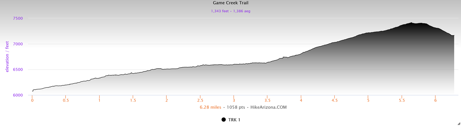
Elevation and route courtesy of Route Scout
Getting There
From Jackson, head west on Broadway Ave. for 7.8 miles. Note: after passing the intersection with Highway 22, Broadway will become Highway 89. After 7.8 miles, look for Game Creek Road on the left. Follow that for 1 mile and park at the trailhead before ascending the hill.