
Distance: 11 miles
Type: Lollipop loop
Difficulty: Strenuous
Kid-friendly: No
Dog-friendly: No
Water: No
The Murphy Trail is an 11 mile round trip lollipop loop hike that starts in the Island in the Sky district of Canyonlands National Park, Utah. The dramatic loop drops down nearly 1,500 feet below the Island in the Sky rim and heads toward the Green River via a beautifully scenic hogback mesa, and then connects with a gorgeous desert wash via the White Rim Road. It’s a fantastic way to get a taste of what Canyonlands National Park has to offer.
View more images available as prints from the Moab, Utah region
Murphy Trail Loop Trail Description
The Murphy Trail begins easily enough as it gently meanders through the high desert grasslands frequently found in the Island of the Sky district. At about 0.25 miles in, you’ll pass an old corral that was used by a cattle rancher prior to the park’s designation. Next you’ll reach a fork where you’ll want to head left to head down toward the rim.
Once past the fork, the trail will narrow as the junipers begin to thicken along the way. You’ll begin to descend gradually along a wash before crossing over it where cairns will begin to guide you along sand and slickrock. Soon enough, you reach the rim where the trail disappears below the next ridgeline.
Descending the Cliffs
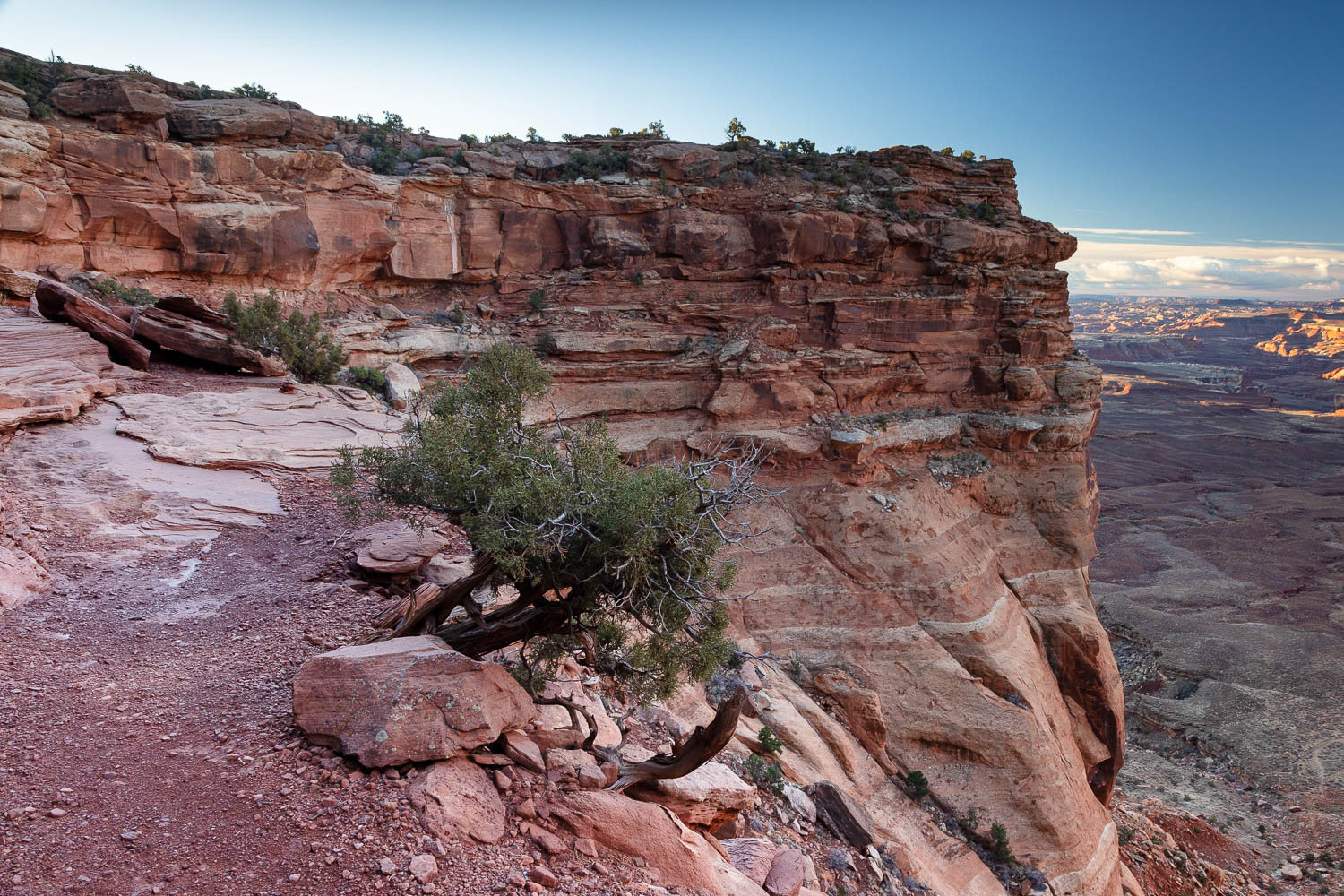
Tucked away between massive Wingate sandstone cliffs, you’re provided with outstanding views into the depths of lower elevations of Canyonlands National Park. Continuing down the trail, the next route often seems to disappear into the rock, but with each step, a path sure enough becomes apparent, often only one step at a time. One switchback after another gradually guides you down the deep descent where the trail is visible far below with nothing but a sheer vertical drop between. Despite the trail only being revealed one precipice at a time, at best, the trail still feels oddly safe and never too risky.
After a steady amount of descending you’ll cross a wooden bridge to help you across a drop next to a cliff. The bridge was originally built over 100 years ago, but was reconstructed in 1998. Once past the bridge, you pass below the Wingate sandstone cliffs and into the Chinle formation where the switchbacks begin to lengthen thanks to a reduction in the steep cliffs. To fully appreciate the climb you just descended, imagine what how hard it must’ve been for the original rancher to move a herd of cattle down that trail! This was the trail’s original use.
Look for cairns to guide you down the switchbacks and rocks where the trail will descend into the wash before reaching the fork to begin the loop. Right leads to the hogback, while left continues down the wash. In this case, I went up the hogback first and saved the wash for later.
Murphy Hogback
The Murphy Hogback Trail ascends very gradually from here up toward the namesake, the colossal Wingate sandstone cliffs towering over you to your right. To the left is an endlessly jagged landscape blurring to the horizon. Along the trail among the blackbrush and other native forms of desert vegetation are flourishing colonies of cryptobiotic soil. Please do not disturb them in any way. These are living colonies of bacteria and soil that take decades to regrow!
As you continue toward the hogback striking bursts of pastel color emerge below the steep cliffs as part of the Chinle formation. Massive boulders with beautiful stripes rest below rockfalls as the trail meanders by. Amongst it all is complete silence, a natural occurrence that’s becoming harder and harder to find, but that has been shown to reduce stress and blood pressure. It’s a vital part of nature that continues to disappear, so stop and enjoy the silence in the still landscape while you can.
Soon the cliffs begin to rise behind you where panoramic views begin opening up to the left and then to the right. The colorful Chinle resting below the Wingate sandstone cliffs can be seen wrapping around the vista as the Green River cuts through it all far below. Standing among it all is Candlestick Tower, a prominent feature in northern Canyonlands National Park. The mesa soon begins to narrow into the hogback at this point as a short spur trail leads to a stunning panoramic view to the north, the Green River visible far below.
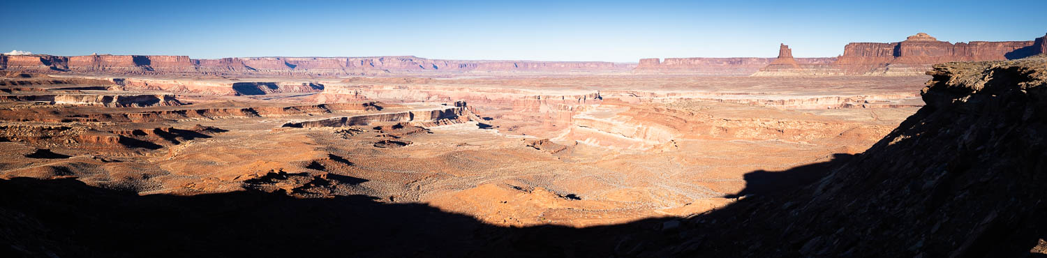
The main trail begins to get a little rockier as it starts to gradually climb a little more. Panoramic views now eastward open up as the trail snakes through the brush to easily climb to the top of the mesa. Soon an outhouse is visible in the distance ahead, a sign of civilization marking the Murphy Campground along the White Rim Road.
White Rim Road
At the White Rim Road, head left to begin the next section of the loop. This will take you through the Murphy Campground, where a remarkable view can be found at the next outhouse behind a large flat balancing rock to the right. Back on the road, there’s a steep descent as you begin to drop down toward the wash. It becomes a bit more gradual as it continues to wind downward, finally reaching the wash, marked by a sign. Turn left to begin heading up.
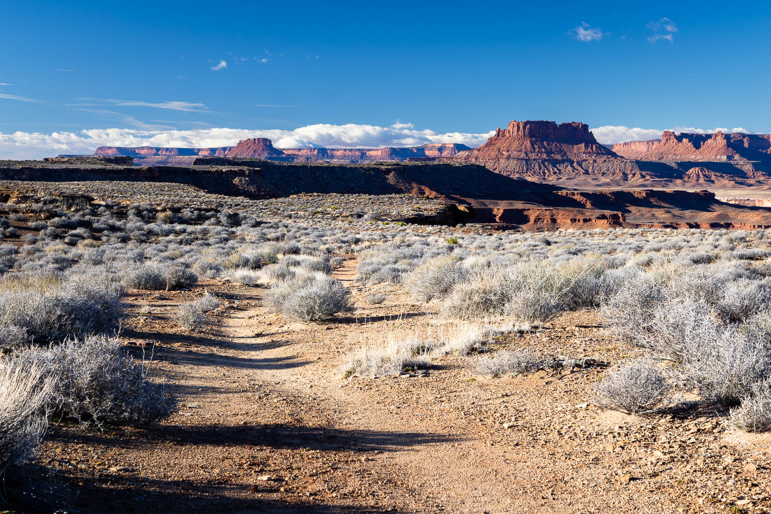
Murphy Wash
Initially, the trail up the wash zigs and zags in the wash as it bumps from one rocky cliff to another. Gone are the panoramic views of the hogback, but in its place is a more intimate beauty of the desert. A wide array of vegetation grow on the banks and even out of the rocks, the giant Wingate sandstone cliffs never out of the horizon for very long.
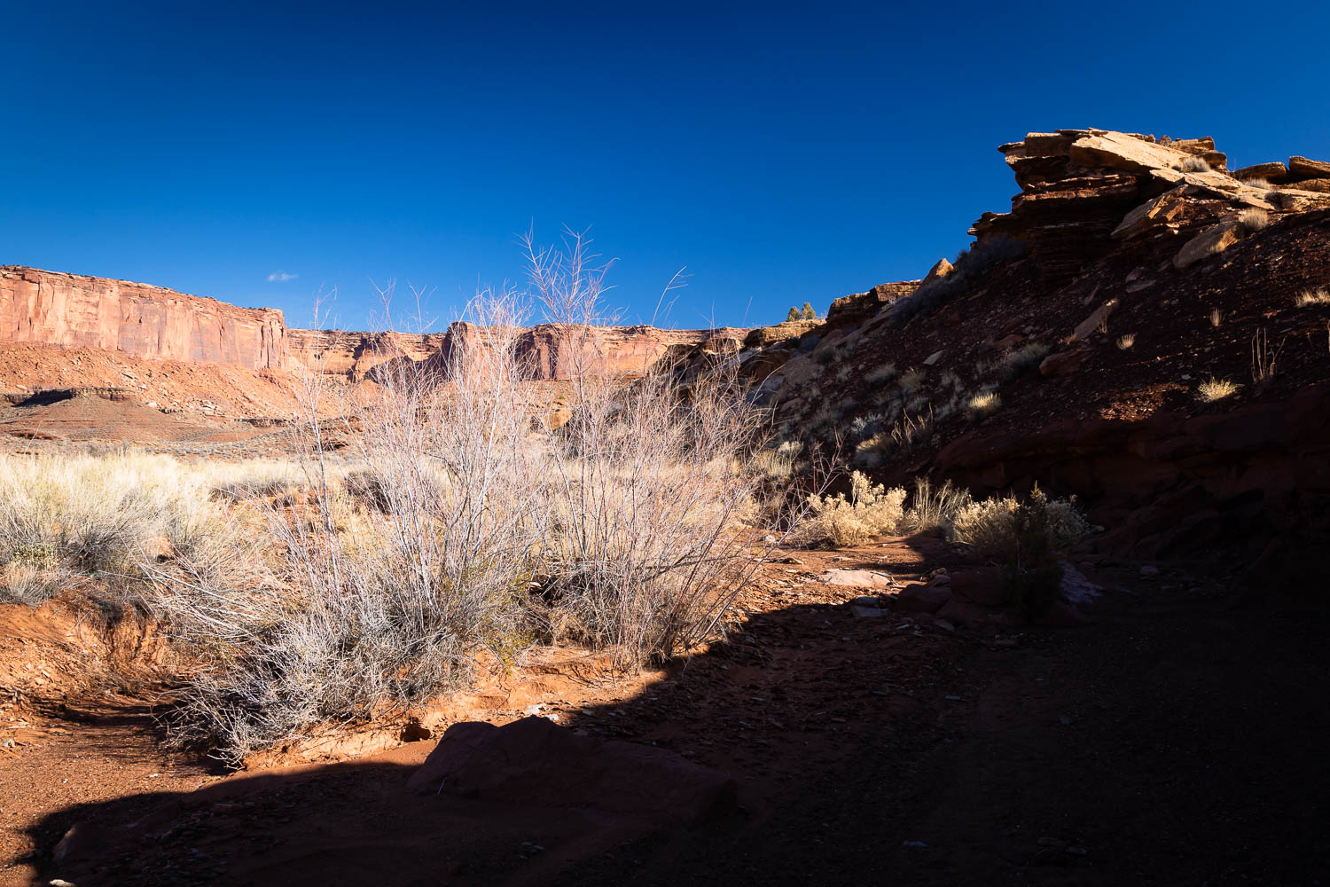
Soon the wash will fork where you’ll want to head left. Look for cairns to guide the way. Next you’ll make a small climb out of the White Rim Sandstone and onto the Moenkopi formation. The wash will narrow and widen a few times as you pass another old corral tucked away below a small cliff. You’ll soon climb into a broader wash where it quickly narrows again where you’ll want to follow another fork to the right.
The trail in Murphy Wash will reach an impasse, but before doing so look for the cairns to guide you out of the wash where a trail will parallel to guide you safely around it. You’ll drop back into the wash once past it. As the wash broadens once again, the trail will get rockier and steeper as you make your way into the Chinle formation. Cairns once again will guide you past relatively large cliffs in the wash where you’ll next be guided into a side wash, then back into the main wash. Here you’ll reach the sign that began the loop, where you’ll begin to make the steep climb back out.
Be sure to bring more water than you think you’ll need. Remember it’s warmer at the lower elevations than on the Island in the Sky, so expect to sweat more than you think you would.
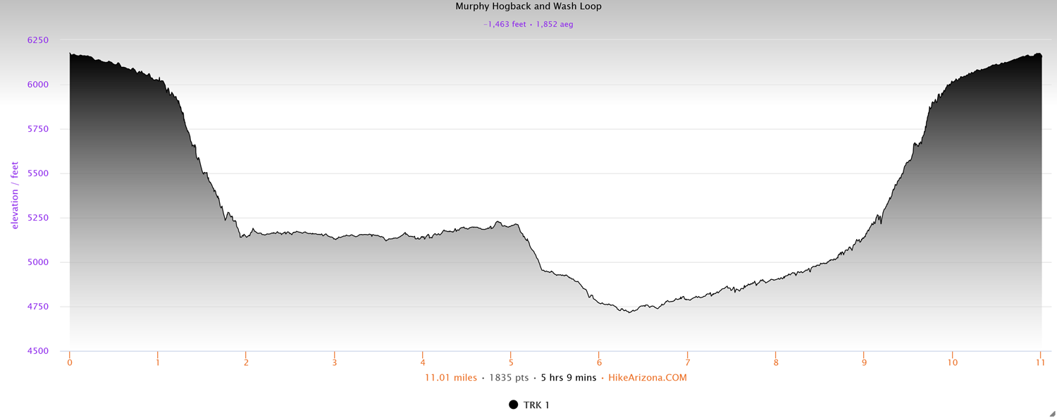
Elevation and route courtesy of Route Scout
Getting There
From the Island in the Sky Visitor Center, head down the main road for 8.75 miles and look for the Murphy Trailhead on your right.