Distance: 3.7 miles
Type: Out and back
Difficulty: Easy
Kid-friendly: Yes
Dog-friendly: No
Water: Yes
The North Rim Trail is an easy 3.7 mile (one way) hike that winds along the North Rim of the Grand Canyon of the Yellowstone River in Yellowstone National Park. Along the way it features numerous breathtaking overlooks of the canyon. In addition, it also features access to stunning views of large waterfalls along the way. Most people will hike small portions of the trail. Far fewer hike it in its entirety. However you enjoy it, there’s surely a great surprise waiting!
The trail can be started at either Inspiration Point, or the Wapiti Lake Trailhead. For this post, I started at Inspiration Point.
View more images available as prints from Yellowstone National Park
North Rim Trail Description
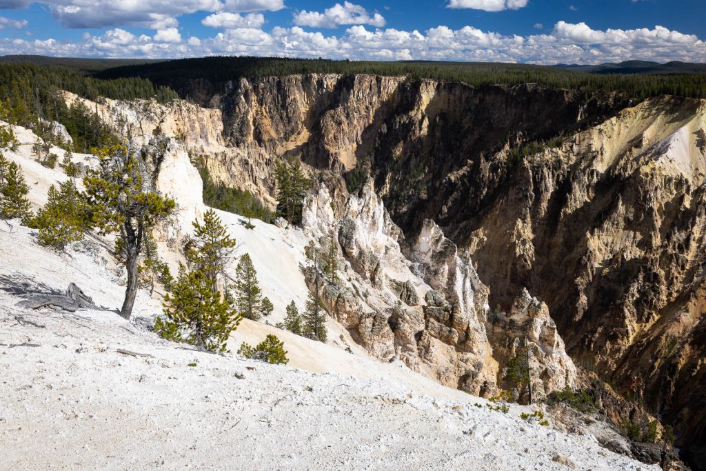
Inspiration Point
Beginning at Inspiration Point, the North Rim Trail starts off with a bang. An immersive view up and down the Grand Canyon of the Yellowstone River unfolds, with Lower Falls only barely visible beyond an obscuring ridge. From the point, the trail bends into the forest, quickly leaving behind the crowds.
Grand View
You’ll emerge from the forest after just over half-a-mile, with stunning views down and into the canyon. On the opposite side, Artist Point is clearly visible. Great views abound as you wind along the literal north rim of the canyon. At 1.3 miles in, you’ll reach Grand View. This provides another stunning view of the canyon, though Lower Falls is still obscured.
Lookout Point and Red Rock Point
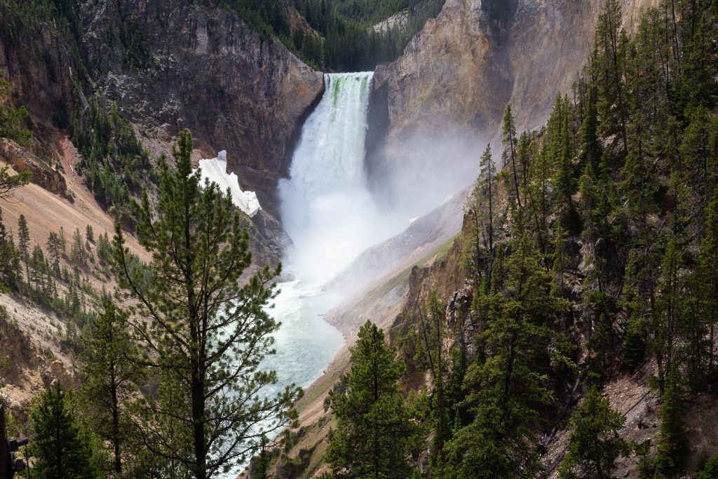
Beyond Grand View, you’ll continue down the rim. After just 0.25 miles, you’ll reach Lookout Point, where you’ll get your first real view of Lower Falls. Optionally, a hike down to Red Rock Point can also be taken to get an up close view of the waterfall at a lower elevation. Be prepared for a steep trip back up if you do though.
Brink of the Lower Falls
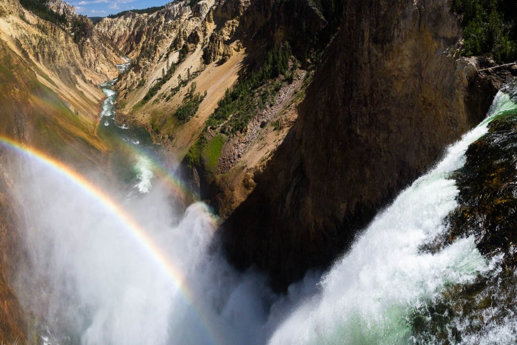
With the loud roar of Lower Falls now permeating the soundscape, the hike through the woods past Lookout Point becomes more enticing. Paralleling the road much of the way to the next point, the views are relatively limited. At 2.1 miles in, however, you reach another optional trail for the Brink of the Lower Falls. The trail is less than 0.5 miles long, but is another steep one coming out. At the bottom though, you’re standing at the top of a 308 foot waterfall as it crashes over the ledge. Whether you take the trail all the way down or not, the North Rim Trail continues down to the first switchback with the Brink of Lower Falls Trail.
Beyond the fork, the trail drops down into a meadow. You’ll quickly reenter the forest and wind down along the canyon rim to a footbridge crossing Cascade Creek. The peaceful forest scene is an unexpected treat along a trail known for its canyon views.
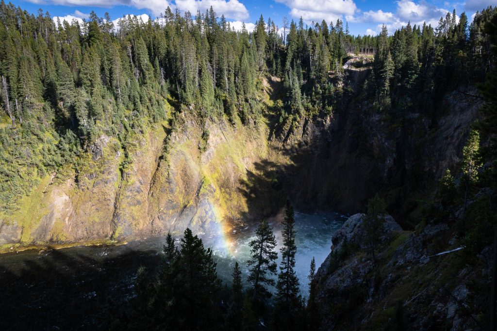
Crystal Falls
Just past the creek crossing, another spur trail leads to another overlook, but not of the canyon. Instead, this quick spur provides a stunning vantage point of Crystal Falls, the product of the creek you just crossed. It marks yet another unexpected but delightful surprise along the trail.
Brink of the Upper Falls
From the overlook, it’s a short distance to the parking area for the Brink of the Upper Falls Trail. Wind around the parking area where the trail is easily located. The short trail down provides a stunning view of the Upper Falls as it drops 109 feet down. Well worth the visit, the view, though smaller than Lower Falls, is somehow still just as wondrous.
Heading upstream from Upper Falls, the trail maintains a paved route for the remainder of the way. It winds along the Yellowstone River, an occasional view through the trees showing off the stunning beauty of the river. An historic bridge is even crossed, originally used for automobile traffic prior to the Grand Loop Road’s current route.
Just beyond the historic Canyon Bridge, you’ll twist up to the Chittenden Memorial Bridge. This marks the end of the North Rim Trail, though the Wapiti Lake Trailhead is just on the opposite side of the bridge and river.

Elevation and route courtesy of Route Scout
Getting There
To begin at Inspiration Point, from Canyon Village, head south on the Grand Loop Road for 1.2 miles. Turn left onto North Rim Drive. Follow that road for 1.3 miles and turn right onto Canyon Rim Trail Road. Park where the road dead-ends at the Inspiration Point parking area.
To begin at the Wapiti Lake Trailhead, from Canyon Village, head south on the Grand Loop Road for 2.2 miles. Turn left onto South Rim Drive. In 0.2 miles, just after crossing the river, turn right into the Wapiti Lake Trailhead parking area.