Distance: 3.25 miles (one way)
Type: Out and back
Difficulty: Moderate
Kid-friendly: Yes
Dog-friendly: Yes
Water: Yes
The Wind Cave Trail is a moderate 3.25 mile (one way) hike in Darby Canyon of the Teton Mountains. At the end of the trail is the titular cave, complete with a waterfall pouring out of the opening early in the summer season. It’s easily one of the more popular trails on the west side of the Tetons and makes for a great day-hike in the area.
View more images available as prints from the Teton Mountains
Wind Cave Trail Description
The trail begins in the woods where it quickly reaches a large meadow with views of the upper mountains above Darby Canyon. You’ll pass through a few more older evergreens before reentering the meadow, this time with Darby Creek flowing below. The trail descends slightly toward the creek and into the trees where a large wooden bridge carries hikers across the rushing water. On the other side you’ll pass through another small meadow before heading deep into the old forest.
The Wind Cave Trail will reach the Jedediah Smith Wilderness at 0.7 miles in where a footbridge carries hikers across a seasonal stream. On the other side the trail begins to climb more steadily as the trees clear at the mouth of the South Fork of Darby Canyon, home to the Wind Cave. The trail begins a lengthy switchback up the hill on the east side of the canyon where it comes back out high above where you were just standing. It then takes a directly southern route ascending up the east side of the canyon.
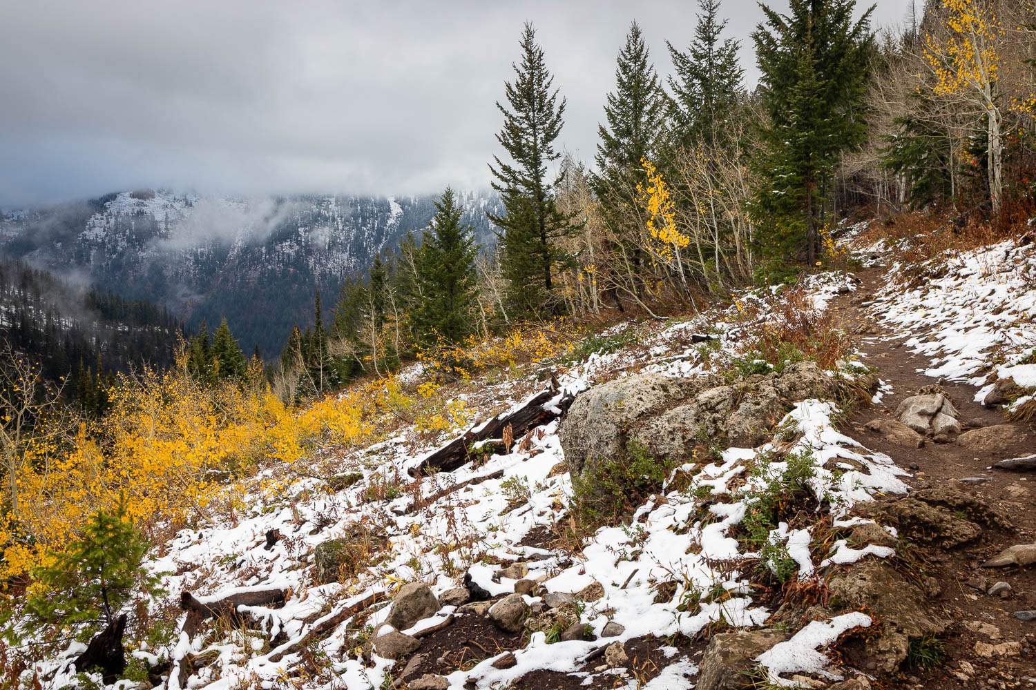
As you continue ascending up the canyon for the next 1.5 miles, four different switchbacks interspersed over a consistent ascent will bring you to the higher elevations of the South Fork of Darby Canyon. Along the way the occasional view of the opposite side of the canyon can be seen through breaks in the forest. A moderate climb gradually brings you higher and higher toward the back of the canyon, where soon aspens begin to replace the constant evergreens you were hiking through in the lower elevations. Around this point the forest begins to thin out, letting you know you’re beginning to make some progress and that the scenery is beginning to change.
With the thinning forest, a few small cliffs become visible shortly ahead. The Wind Cave Trail at this point cuts back to the west to cross a small seasonal creek just below the cliffs at 2.5 miles in. On the other side, the trail ascends the opposite side of the canyon through a thick forest. It then crosses a few broken meadows before crossing a larger meadow. On the other side is the last climb before reaching the Wind Cave.
Once on the other side of the meadow, the trail climbs up through a broken forest. At 3 miles in, you’ll reach a memorial with a plaque commemorating a small group that was tragically struck by lightning at that spot. A steep climb begins from here with numerous signs asking hikers not to cut through switchbacks, and why would you? You’ve already hiked 3 miles. How much time and energy are you really going to save by causing erosion to a mountainside?
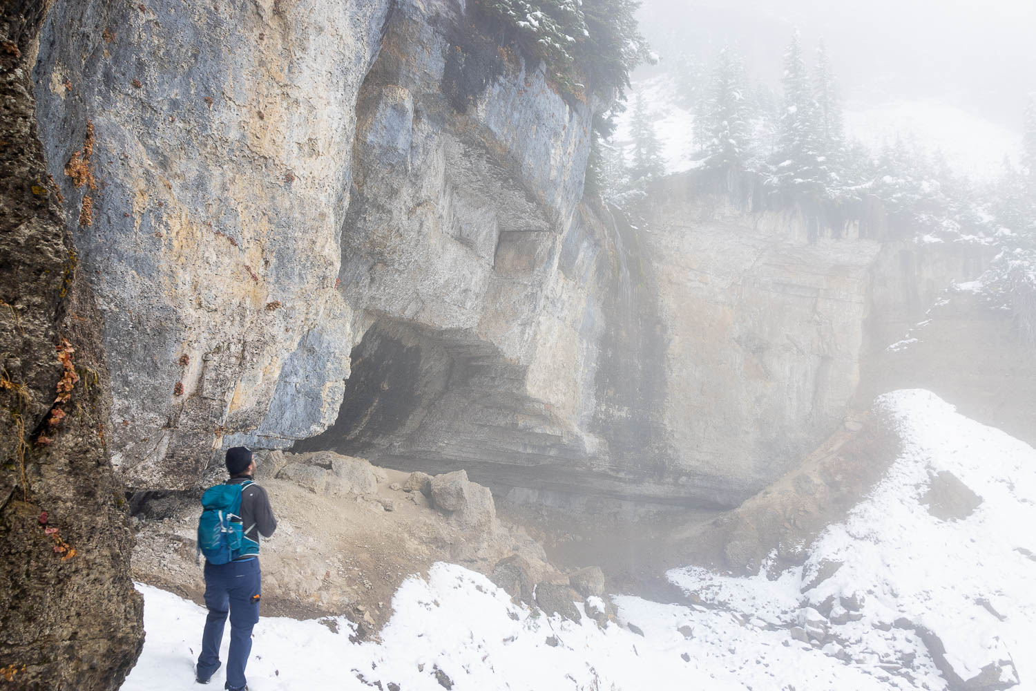
At 3.1 miles in, you’ll reach a large cliff with a smaller cave below. Early in the season, or after a snowfall, you’ll find a waterfall pouring above the small overhang. The trail will continue up a brief staircase as it climbs steeply toward the next switchback, after which an easy ascent takes you up to the base of the Wind Cave. The seasonal waterfall will originate from the cave itself, fueled by nothing more than snow melt. It should go without saying that you shouldn’t explore the cave unless you have a comfortable amount of spelunking experience. Dangers in and around the cave are very real and you should exercise extreme caution around the mouth of the cave. Definitely enjoy the view though, and once you feel like you’ve enjoyed the scenery enough, head back out the same way you came in.

Elevation and route courtesy of Route Scout
Getting There
From Victor, Idaho, head north along Highway 33 for 5.3 miles. Turn right onto W. 3000 S. and head straight for 3.2 miles, where the road dead-ends. Head right and follow the road until it dead-ends at the trailhead parking lot.