Distance: 2.6 miles (one way)
Type: Out and back
Difficulty: Strenuous
Kid-friendly: No
Dog-friendly: No
Water: No
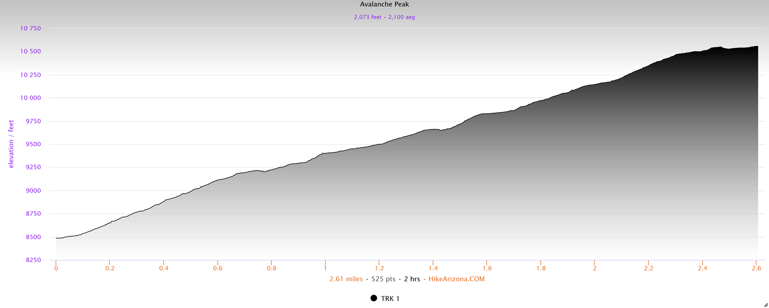
The hike up to Avalanche Peak is a brutally strenuous 2.6 mile trek that brings hikers up to a stunning 360 degree panoramic vista atop the eastern boundary of Yellowstone National Park. The trail climbs a grueling 2,000 feet in just over 2 miles, setting a daunting and challenging pace. Likewise, with no water available along the trail, hikers should be ready for a challenge and be in decent enough shape to carry enough water without weighing themselves down. Despite the challenges, the view from the summit is unparalleled and an absolute must-do for anyone visiting the area!
Avalanche Peak Trail Description
The hike up to Avalanche Peak begins between Sylvan Lake and Sylvan Pass along East Entrance Road in Yellowstone National Park. Look for the trail on the opposite side of the road as the trailhead. The trail will immediately begin climbing and doesn’t let up until you’re near the summit. Right away, you’re engulfed in a thick and intimate forest. The sound of a flowing creek nearby soon becomes audible as you gain elevation.
Roughly 0.75 miles in, you’ll reach a scenic meadow where you’ll drop down toward a dry creek bed filled with wildflowers. Once you’ve crossed the creek bed, the climb resumes again, continuing its steep ascent.
Farther up, you’ll begin to notice the forest thinning a bit as whitebark pine trees become more prevalent. You may also notice white pheromone patches on the trees. This is to ward off the pine bark beetle, already having an obviously detrimental effect on the endangered trees.
Maintaining the steady climb, you’ll begin to see views of the surrounding peaks across the pass through the trees. Heading up mountainside, you then soon emerge at the base of a large alpine bowl. The stunning view shows off the lower elevations of Avalanche Peak and its nearby neighbor. This inviting setting makes for a great place to rest if desired. Likewise, if anyone has a fear of heights, this might make for a good place to turn back.
When ready, continue up the trail where you’ll begin climbing up talus and scree. The steep climb opens up tremendous views of the peaks directly to the south. Gaining elevation up the brutally steep ascent, the trees will begin to thin out a bit more as the highway and trailhead can be made out far below through the trees. Shortly after, Yellowstone Lake also comes into view. It’s around this point that anyone with a fear of heights may begin to question their decision for this hike.
You’ll soon reach a switchback at a big overlook of Yellowstone Lake with the highway descending toward it. The trail will continue climbing steadily, reaching a small plateau. It’s here you’ll notice the trees have thinned significantly, finally cresting treeline. From this vantage point the summit of Avalanche Peak becomes clearer, towering ahead but now within reach.
With all around phenomenal views, you’ll reach an unsigned fork just up the trail. Both ways will take you up to the summit. While right is a more gradual ascent, left is steeper but achieves awe-inspiring views not very far up. The next part of this post reflects going left.
The steep and steady climb through talus and tundra culminates quickly at unparalleled views over Yellowstone. You’ll then begin heading along the crest of the ridge toward Avalanche Peak, the bulk of the elevation change now behind you. Outstanding panoramic views invite you to stop and admire on your way to the final summit. At a wind shelter along the way, you’ll connect with the trail that went right just moments ago.
Once you pass a rocky false summit, Avalanche Peak finally comes into clear view. With the smooth summit straight ahead, the final short stretch is an easy shot over. At the summit, you’ll find several wind shelters to shield yourself from any breezes or wind when you’re not enjoying the 360 degree panoramic views of Yellowstone and the surrounding wilderness.
Elevation and route courtesy of Route Scout
Getting There
From Fishing Bridge, head east on East Entrance Road for 17.5 miles. After passing Sylvan Lake, look for the trailhead on your right. The trail will begin on the opposite side of the road as the trailhead.