Distance: 4.1 miles
Type: Out and back
Difficulty: Strenuous
Kid-friendly: No
Dog-friendly: Yes
Water: Seasonal
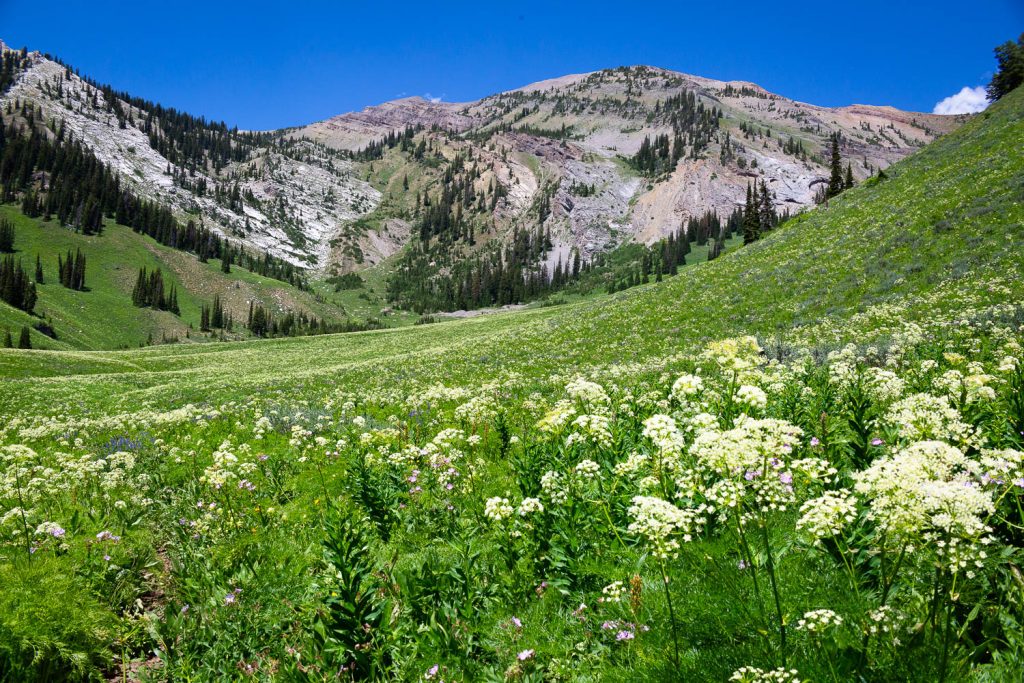
The hike to Boulder Basin is a strenuous 4.1 miles in to a remote section of the Gros Ventre Highline Trail in the Gros Ventre Wilderness. The trail is relatively infrequently traveled, so it gets overgrown in a few spots as well as also deteriorating in locations from a lack of maintenance. However, if you’re willing to brave those aspects, you’re wonderfully rewarded with a spectacular remote location bursting with lush wildflower meadows.
Boulder Basin Trail Description
To begin up toward Boulder Basin, first backtrack up the road for 0.25 miles. Across the main road, you’ll see the trail ascending up the hillside past a small sign. You’ll quickly enter a mix of aspen and conifer as the climb proceeds steadily through a thin forest. The relentless climb offers up an occasional view through the trees, which also makes for a good opportunity to catch your breath if needed. At 1.3 miles in, you’ll reach the Gros Ventre Wilderness boundary. This will be marked by a small sign on a tree.
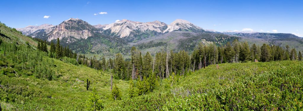
Continuing to climb, you’ll reach a partially young forest where the mountainside begins to open up. Behind you, immense views of the peaks to the east crown the horizon. As you brush through the bushes, you’ll make your way up to a ridgeline showing off panoramic views eastward. It’s also here that the trail will go from a southwestern direction to more northwestern.
Through this section, you’ll notice burned trees from a forest fire a couple of decades prior. The young forest is regrowing along the trail in sporadic segments as you maintain a steady ascent, though not as steep as what you just came up. After providing a few more stunning views of the eastern peaks, you’ll bend up into an aspen grove. Just before entering, you’ll have incredible views southward toward the Wyoming Range.
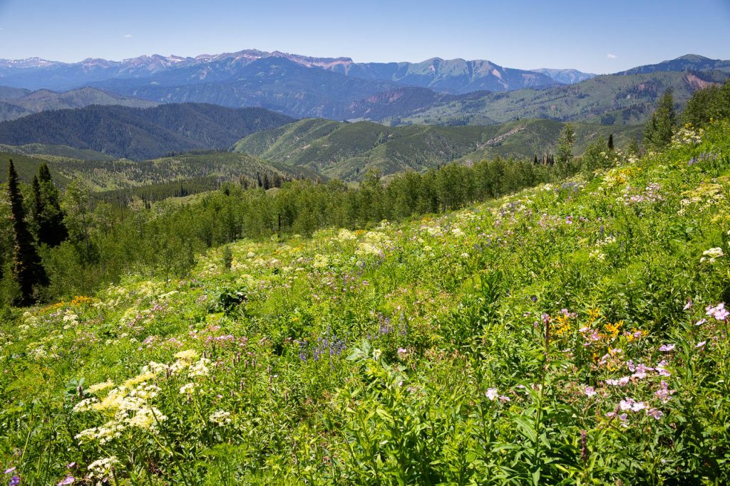
You’ll continue to snake along the ridgeline as the trail more or less begins to level out. As you wind through an occasional aspen grove, you’re treated now to big western views as well. You’ll pass through more groves, both aspen and evergreen, and in between is where you’ll notice the trail can get a bit overgrown. As a result, it can be slightly difficult to follow in some places.
Soon you’ll begin wandering along a large exposed hillside. The trail will guide you in and out of the various drainages that keep the trail winding. Continue along this route and after popping through a brief aspen grove, you’ll begin to see the Boulder Basin peeking out above the hills. After making a brief ascent, you’ll pop into another large exposed hillside where you can follow the trail down below the basin. There’s a small evergreen grove just above a creek that makes for a great destination. Enjoy the scenery as long as you’d like and head back out the same way you came in.
Getting There
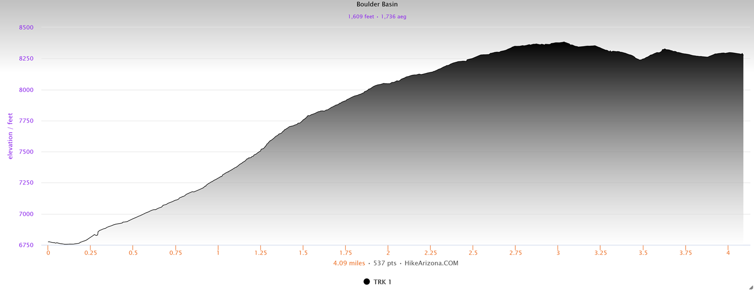
Elevation and route courtesy of Route Scout
From downtown Jackson, head west on Broadway Ave., continuing south along Highway 89. Continue heading south out of Jackson toward the Hoback Junction. At the Hoback Junction, head south along Highway 191 for 11.4 miles. Turn left onto Granite Creek Road and head up the dirt road. Follow the main road for 7.9 miles, heading right at a major fork. Make a right turn at a sign for Trailhead Parking, Safari Club International, and Girl Scout Camp. Head across the creek and at the next fork, head left to the trailhead parking just a short distance later. To access the trail, backtrack across the creek and cross the main road.