Distance: 4.6 miles (one way)
Type: Out and back / Shuttle
Difficulty: Moderate
Kid-friendly: Yes
Dog-friendly: Yes
Water: Yes
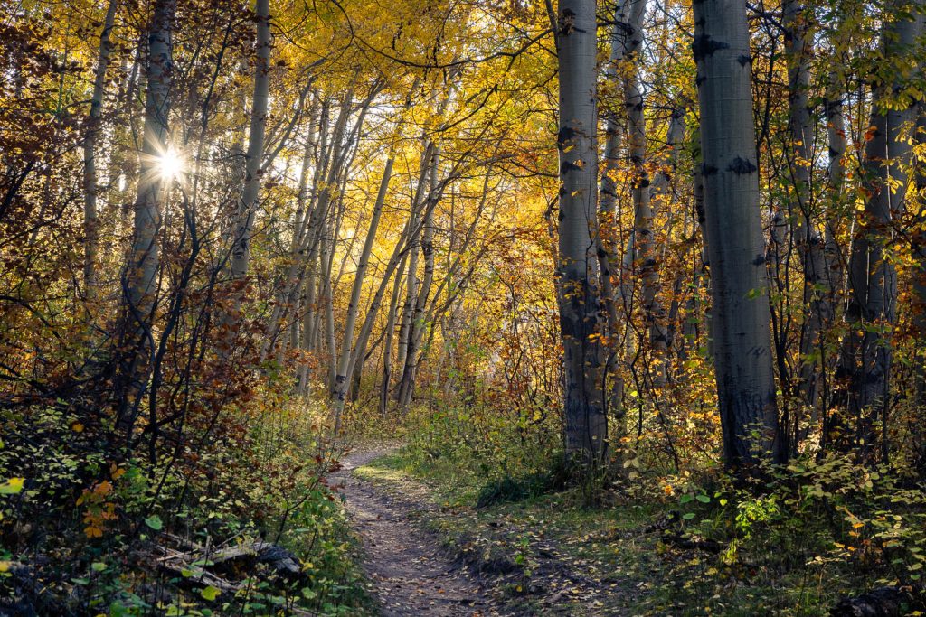
The Aspen Trail is a 4.6 mile (one way) trail in the western foothills of the Teton Mountains, bringing hikers through countless groves of aspen trees. It’s a scenic hike high above Teton Valley with spectacular displays of both summer and fall aspen trees. The trail can be accessed from either the north or south side, with neither side being any more difficult than the other, though both offering dazzling aspen foliage. This writeup was written by beginning at the south end and heading north, though it’s easy enough to reverse if you choose.
View more images available as prints from the Teton Mountains
Aspen Trail Description
From the parking area, begin by heading up the trail, which quickly ascends via switchbacks through large aspen groves. Through the trail ascends quickly, it never gets too steep to be considered challenging. The trail switchbacks and zigs and zags through the endless aspen forest that you immediately begin to wander through. Here and there the trail levels out for a moment, some stretches longer than others.
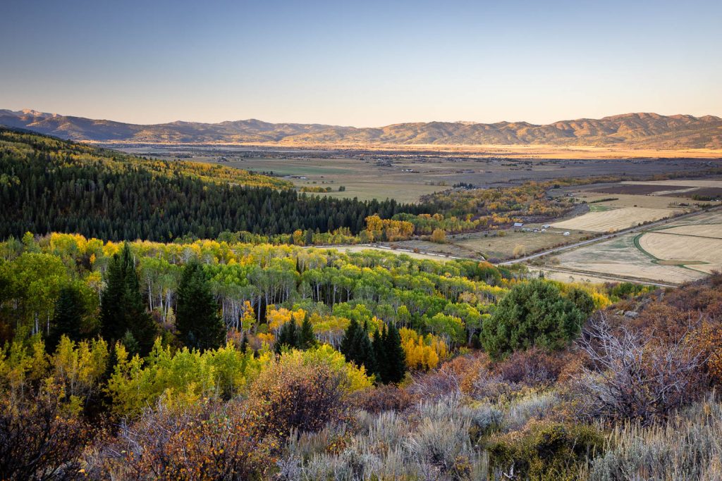
At 0.8 miles in, you’ll reach an exposed hillside with a beautiful view stretching out over Teton Valley, capped by the Big Hole Mountains in the distance. The trail quickly resumes its course through aspen trees, now mixed with evergreens, only to reemerge into the open at 1 mile in. There’s a gradual ascent with views of Teton Valley once again, along with the mouth of Darby Canyon, cutting northward shortly after. If you’re looking for a shortened version of this trail, this makes for a great place to turn around.
You’ll follow a gradual descent through an aspen grove with sprawling views stretching out to the north visible once through the trees. The gradual descent continues through aspens, evergreens, and many other forms of mixed vegetation. You may also notice how quiet the trail is, with only a distant hum audible emanating from Teton Valley.
Through the trees, you’ll occasionally pick up a quick glimpse of Teton Valley as the Aspen Trail gently bobs up and down over the Teton Mountain foothills. At 2 miles in, the vegetation changes considerably as you enter an evergreen forest. Shortly after, a series of creek crossings begin, some with small footbridges, others over rocks. If you’re once again looking for a destination to shorten the hike to, this also makes for a great destination, giving you a nice 4 mile in-and-out hike. Once past the third creek, the trail will begin ascending alongside the creek where switchbacks will begin to bring you higher, ultimately bringing you up and over the foothill via a gradual ascent.
Soon the aspens once again begin replacing the evergreens producing another mixed forest. At 2.8 miles in, you’ll cross a few more small footbridges to safely bring you over a slightly boggy area. Just beyond is a steep but short climb up another exposed hillside, the Big Hole Mountains waning to the north as they melt into the Snake River Plain.
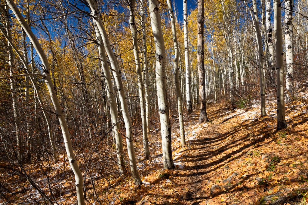
The Aspen Trail continues north through a mixed forest, dominated mostly by the namesake aspens. You’ll make one more creek crossing at 3.75 miles in, followed by a relatively steep descent after passing through noticeably windswept aspen trees rising above. A dense aspen grove follows, coupled with a continued relatively steep descent through continuous aspens, the trail widening into an old forest road. From here, the trail maintains its descent until the northern trailhead. You’ve hopefully arranged a shuttle if you don’t want to hike more. If you’d like to turn the trail into a lengthy day-hike, head back out the same way you came to see it all from a different direction!
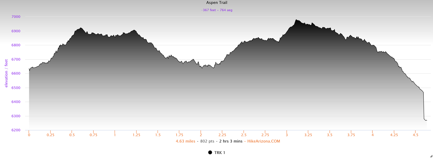
Elevation and route courtesy of Route Scout
Getting There
From Victor, Idaho, head north on Highway 33 for 5.3 miles, taking a right onto W. 3000 S. and following that until it dead-ends at Stateline Road 3.2 miles in. Turn right onto Stateline Road and it will quickly cut 90 degrees east, heading into Darby Canyon. Follow the dirt road for 1 mile and look for the small parking area with a large sign at the trailhead.