Distance: 1.2 miles (one way)
Type: Out and back
Difficulty: Easy
Kid-friendly: Yes
Dog-friendly: No
Water: No
The Hickman Bridge Trail is an easy 1.2 mile (one way) in the base of the Waterpocket Fold to a large natural arch of Capitol Reef National Park, Utah. It’s one of the more popular trails in the park, offering visitors the opportunity to see some signature sandstone formations and get a great sampling of the Waterpocket Fold.
View more images available as prints from Capitol Reef National Park
Hickman Bridge Trail Description
From the trailhead, the beginning few-tenths of the trail are the most challenging. After walking along the Fremont River for a short distance, the trail climbs over only a couple tenths of a mile, bringing you up to a small plateau over a short, but steep staircase. There are some pretty great views from where the trail tops out after its climb, including a fantastic view of Pectol’s Pyramid directly to the south. Up the trail a bit farther, a signed fork allows you the option to take the Rim Overlook/Navajo Knobs Trail, or to continue to Hickman Bridge, continue left as indicated.
An easier climb continues as the trail meets up with the wash downstream from the bridge before dropping down into the wash itself. Please do not take any of the side trails that veer out of the wash. Follow the main trail through the sandy wash to avoid trampling any of the fragile vegetation that other people did.
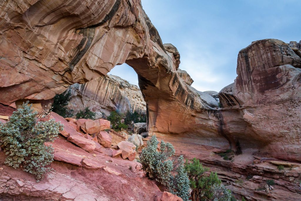
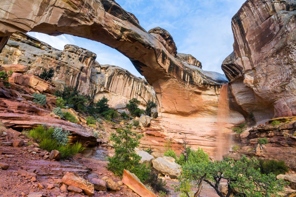
After passing by distinct waterpockets that line the wash on the right, the trail veers slightly to the south to leave the wash. Look for the cairns to help you navigate the proper route. Shortly after, the trail cuts north, marked by a sign that informs you that you’ll be making a small loop through the bridge. As you work your way over slickrock guided by cairns, the first glimpses of Hickman Bridge come into view; a spectacular sandstone bridge spanning over a large gorge. Continue heading toward it via the cairns to get even better views.
Pass under the bridge to get a good sense of its size and majesty, and, if desired, find an interesting vantage point to get a different perspective on it. Once you’ve enjoyed the views, continue on the trail from the west side of the bridge as it heads back south, then east to rejoin the beginning of the short loop. From there, hike out the same way you came in.
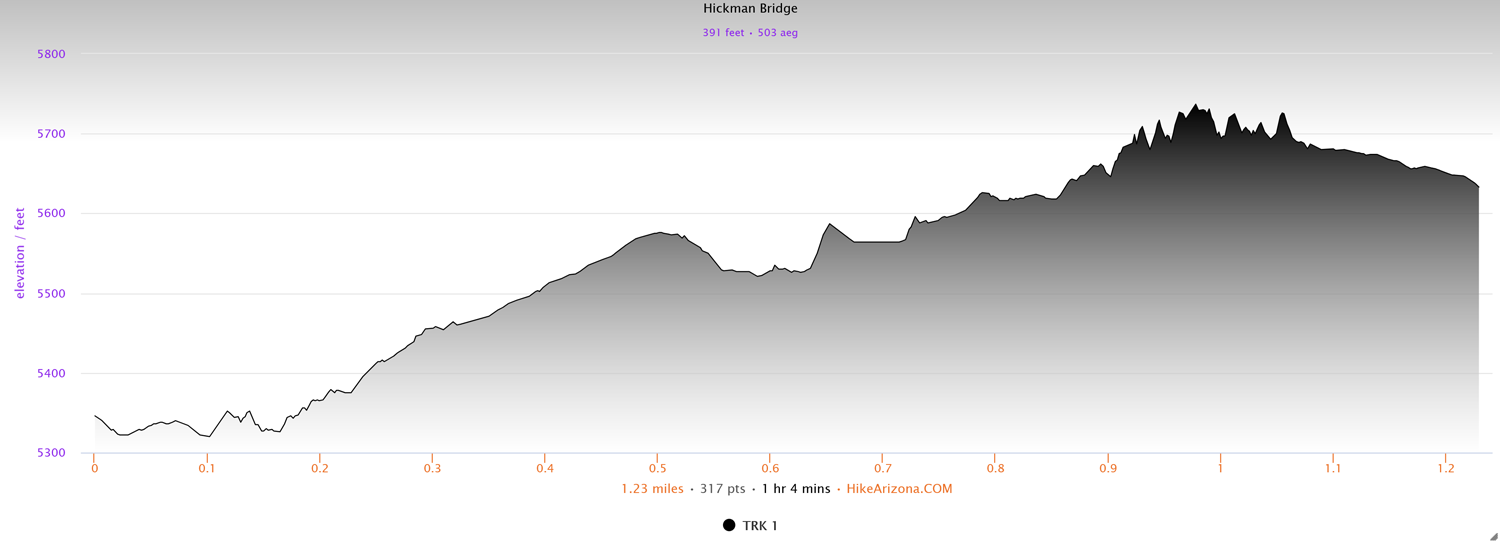
Elevation and route courtesy of Route Scout
Getting There
From the Capitol Reef National Park Visitor Center, drive just under two miles east on Highway 24. The parking area will be on the left and will also be signed from the highway.